


Voting District 10054, Los Angeles County, California
About
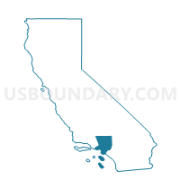
Outline

Summary
| Unique Area Identifier | 533120 |
| Name | Voting District 10054 |
| County | Los Angeles County |
| State | California |
| Area (square miles) | 2.44 |
| Land Area (square miles) | 2.41 |
| Water Area (square miles) | 0.03 |
| % of Land Area | 98.91 |
| % of Water Area | 1.09 |
| Latitude of the Internal Point | 34.07931410 |
| Longtitude of the Internal Point | -118.03123140 |
Maps


Graphs
Select a template below for downloading or customizing gragh for Voting District 10054, Los Angeles County, California


Neighbors
Neighoring Voting District (by Name) Neighboring Voting District on the Map
- Voting District 10051, Los Angeles County, CA
- Voting District 10060, Los Angeles County, CA
- Voting District 10081, Los Angeles County, CA
- Voting District 10720, Los Angeles County, CA
- Voting District 10723, Los Angeles County, CA
- Voting District 10807, Los Angeles County, CA
- Voting District 10813, Los Angeles County, CA
- Voting District 55589, Los Angeles County, CA
- Voting District 55604, Los Angeles County, CA
- Voting District 55841, Los Angeles County, CA
Top 10 Neighboring County Subdivision (by Population) Neighboring County Subdivision on the Map
Top 10 Neighboring Place (by Population) Neighboring Place on the Map
- El Monte city, CA (113,475)
- Arcadia city, CA (56,364)
- South El Monte city, CA (20,116)
- North El Monte CDP, CA (3,723)
Top 10 Neighboring Elementary School District (by Population) Neighboring Elementary School District on the Map
- El Monte City Elementary School District, CA (82,353)
- Mountain View Elementary School District, CA (57,014)
Top 10 Neighboring Secondary School District (by Population) Neighboring Secondary School District on the Map
Top 10 Neighboring State Legislative District Lower Chamber (by Population) Neighboring State Legislative District Lower Chamber on the Map
Top 10 Neighboring State Legislative District Upper Chamber (by Population) Neighboring State Legislative District Upper Chamber on the Map
- State Senate District 29, CA (881,748)
- State Senate District 24, CA (850,013)
- State Senate District 30, CA (848,551)
Top 10 Neighboring 111th Congressional District (by Population) Neighboring 111th Congressional District on the Map
Top 10 Neighboring Census Tract (by Population) Neighboring Census Tract on the Map
- Census Tract 4325, Los Angeles County, CA (8,210)
- Census Tract 4326.01, Los Angeles County, CA (6,564)
- Census Tract 4324.02, Los Angeles County, CA (6,310)
- Census Tract 4332, Los Angeles County, CA (6,163)
- Census Tract 4327, Los Angeles County, CA (5,262)
- Census Tract 4331.02, Los Angeles County, CA (5,085)
- Census Tract 4333.04, Los Angeles County, CA (4,726)
- Census Tract 4335.04, Los Angeles County, CA (4,679)
- Census Tract 4315.02, Los Angeles County, CA (4,361)
- Census Tract 4315.01, Los Angeles County, CA (4,107)